Niderfeld Dietikon: an urban development project set to go ahead
Mit dem Niderfeld entwickelt Dietikon auf rund 40 Hektar eines der grössten zusammenhängenden Entwicklungsgebiete im Limmattal. Nach einem jahrzehntelangen Planungsprozess steht das Niderfeld kurz vor der Rechtskraft. Der Beitrag gibt einen Überblick über die städtebauliche Konzeption, die vorgesehenen Nutzungen, die verkehrstechnische Erschliessung sowie die nächsten Schritte bis zur Realisierung.
A journey spanning decades towards the construction project
The development of Niderfeld has a long history. When it was designated a cantonal centre area in 2010, the site gained additional strategic importance for urban development in the Limmat Valley.
For decades, changing planning frameworks prevented any concrete development from taking place. The establishment of the Niderfeld Dietikon Landowners’ Association (VGND) on the initiative of Balz Halter in 2012, followed by the collaborative masterplan process between the city and the landowners from 2013 onwards, created the ideal organisational and planning conditions for the project’s further development.
Today, the design plan, the urban development agreement and the neighbourhood plan are in place. The proposal is currently undergoing the political consultation process. The next steps in the procedure include deliberations in the municipal council and the planned referendum.
Key figures: Living, working, life
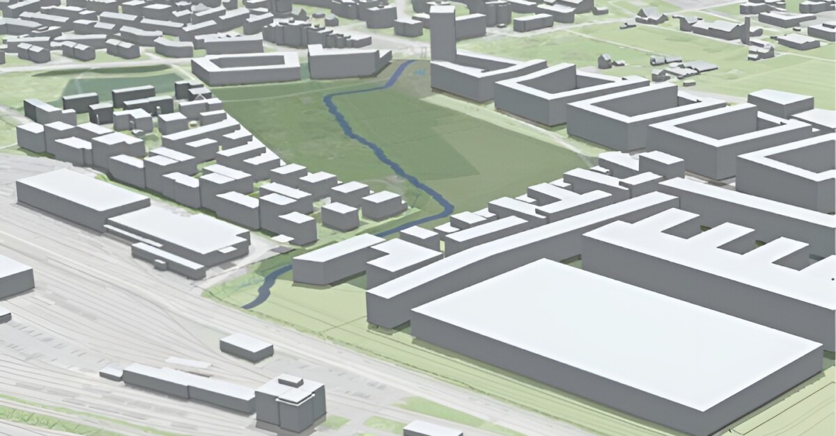
Covering an area of around 40 hectares, Niderfeld is one of the larger urban development areas in the Limmat Valley. The plans provide for around 2,000 flats for some 3,700 residents, as well as around 2,700 jobs. The neighbourhood will be complemented by a school building with a triple-hall sports hall, nurseries and childcare facilities.
The master plan divides the area into five zones with clearly defined functions and densities. The employment zone in the west covers around 121,000 m² and is physically separated from the residential area. Around 68,000 m² is earmarked for housing, with a further 60,000 m² set aside for mixed-use development comprising commercial and residential elements. Public facilities such as schools and sports facilities occupy around 18,000 m².
The central spatial feature of the neighbourhood is a city park covering around 57,000 m². It connects the various sub-areas and plays an important role within the overall structure as an open space and a link between them.
The urban structure is characterised by high-density development along the Überlandstrasse, whilst the inner areas are designed with a stronger focus on housing and open space.
Transport and mobility: Public transport at the heart of Limmatal
The Limmattalbahn plays a central role in serving the new district: it runs through Niderfeld, serving two stops.
The mobility concept prioritises public transport, as well as walking and cycling. Private motorised transport will be concentrated on a few access roads and largely separated from the residential and mixed-use area. A separate access system is planned for the employment area, which is intended to prevent heavy goods vehicles, in particular, from passing through the heart of the neighbourhood.
A dense network of footpaths and cycle paths connects the site with the neighbouring neighbourhoods and provides safe crossings over the transport routes that currently act as major barriers.
Planning and timetable: Implementation scheduled to begin in 2028
An overview of the key milestones:
Current status: The local council is currently deliberating on the planning documents, which have been revised following the 2023 public consultation.
2027: Expected referendum and start of project planning
From 2028: Planned start of construction work and the phased implementation of access routes and infrastructure.
By around 2032: Implementation of the key development phases
An example of cooperative site development
Niderfeld is the result of a collaborative process developed over more than two decades between private landowners, the town and the canton. The Niderfeld Dietikon Landowners’ Association (VGND) is responsible for coordinating between the various stakeholders. On the one hand, it is important that the views and interests of the various landowners can be discussed and reconciled amongst themselves. On the other hand, this enables the landowners’ interests to be represented collectively in dealings with the authorities and planners. This significantly facilitates cooperation for all those involved.
For years, the development of the area was characterised by changing planning frameworks, differing interests and political procedures. The fact that the project was able to continue and be consolidated in terms of planning under these conditions is a prime example of the importance of coordinated processes in complex site developments.
Text: Josef Widerkehr • Image: courtesy of the publisher