City view of Bern is accessible in 3D
Bern has made the 3D model of the city accessible to the general public. It includes all existing and projected buildings, bridges and vegetation. In this way, the city can be virtually explored and measured on a computer or smartphone.
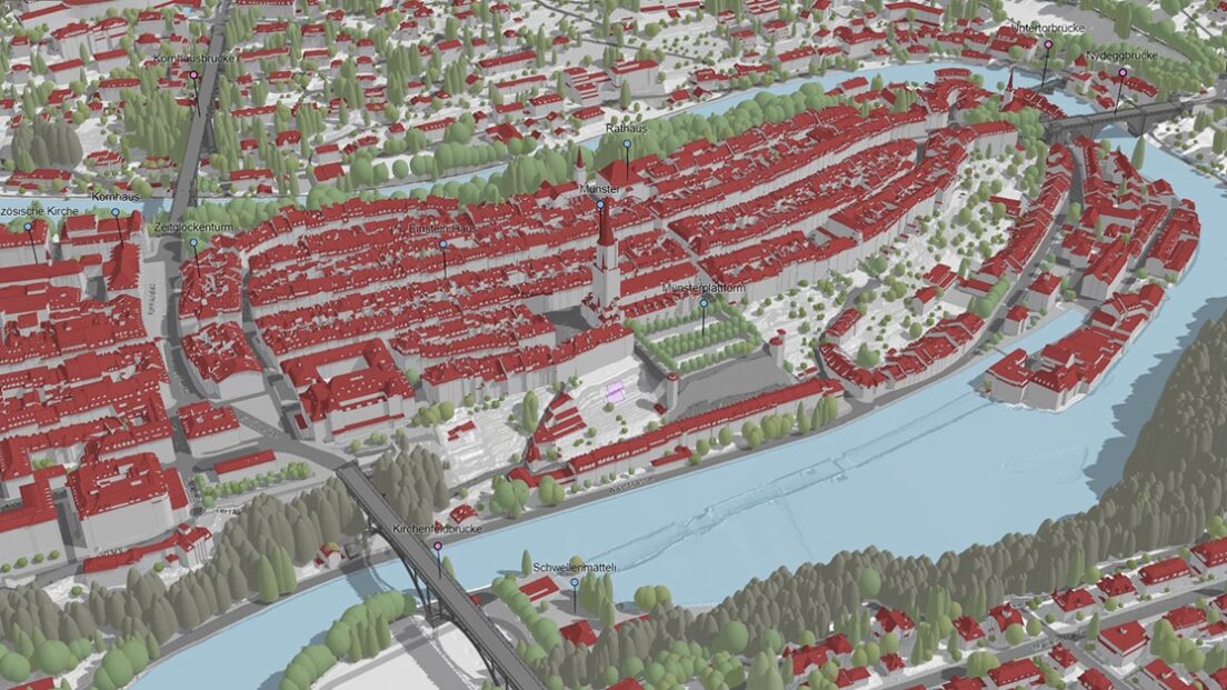
Bern makes the three-dimensional view of the entire city publicly available. So far it has only been accessible to municipal offices and other interested parties. An Internet browser or a newer smartphone is sufficient for access.
As the city of Bern informs , the city model includes all existing and planned buildings in the city. It also shows the most important bridges in detail. The vegetation can also be added as a 3D object or as a point cloud. The sub-municipalities were also supplemented using freely available data from the Federal Office of Topography.
As a video shows, you can find out how high the Bern Minster is by zooming, sliding and rotating. In addition, it becomes clear which shadow course a building shows on a cloudless day. With the measuring tools control element, distances and building heights can be taken from the model. For example, the linear distance between two placemarks can also be determined. Much more information is also available via a link to the city map.
Experts from urban planning, architecture and landscape design can also switch on official surveying data for their projects. For a processing fee, the city of Bern also offers to prepare and submit the data according to customer requirements.